In the context of the GBA, there are some cities more at risk than Macau
Macau Business | July 2024 | Special Report | How climate change(s) Macau
A team of scientists, including Long Zhou, from the Faculty of Innovation and Design at City University of Macau, identified what they called “flood hazard risk zones for the high-density urban areas in Macau,” having concluded that “the areas most affected by flooding is concentrated along the western coastline of the Macau Peninsula, including the area close to the coastline from Inner Harbor South and Rua da Praia do Manduco to the Ilha Verde Industrial Zone, especially the area around Inner Harbor, which is severely affected by rain and flooding due to to its low-lying topography.”
In addition to the abovementioned areas, the areas around Avenida Horta e Costa and Avenida da Almeida, some areas around the Lisboa Hotel also have a high risk of flooding.
In contrast, the vast majority of the areas within the buffer zone of the Historic Centre of Macau are at the lowest risk of flooding due to their high topography.
But due to its size and the context in which it operates, this problem cannot be seen in isolation, which is why there are more and more studies that analyse the risk of flooding in the context of the Greater Bay Area (GBA).
“As climate change intensifies, extreme weather events, especially coastal flooding, is becoming increasingly severe,” states a research paper authored by a team of mainland scientists who investigated “climate risk assessment and adaptation ability in China’s coastal urban agglomerations” (2024).
The authors assume that “carbon emissions exacerbate climate change, leading to increased frequency and intensity of extreme precipitation, which may result in flooding,” and they focused the research precisely on the GBA.
The result shows that Huizhou in the east of the GBA and Zhaoqing in the northwest have the highest level of flood disaster risk.
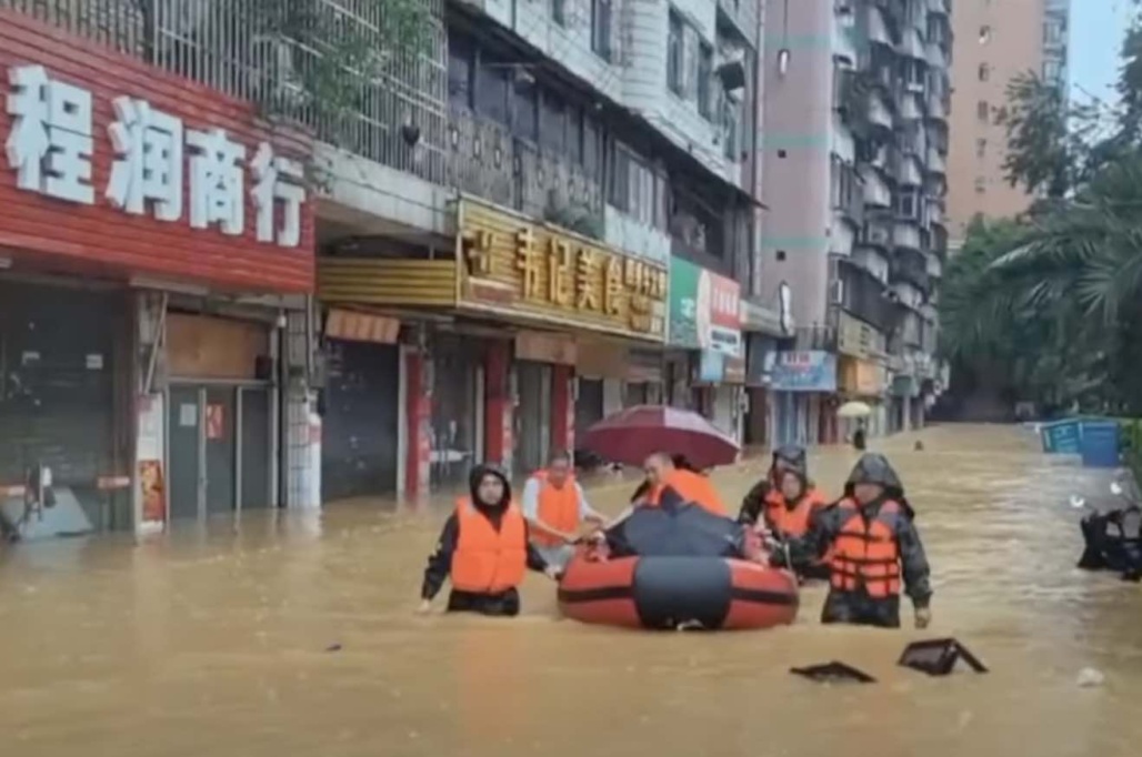
However, the central region of the GBA, which includes Guangzhou, Dongguan, Zhongshan, and Foshan, is highly susceptible to disaster-inducing environments and hazard-affected bodies. This means that the flooding risk and its impact in the GBA region exhibit distinct characteristics and spatial patterns.
And if the regions with the highest flood disaster risk are Guangzhou, Foshan, Dongguan, and Zhongshan along the Pearl River estuary, Zhuhai and Macau seem more ‘sheltered’.
What this research also shows is that “areas with higher levels of urbanisation and more developed economies will face higher flooding risks.”
At the same time, the research results highlight that “ecological protection has a positive effect on reducing flood risk.”
In the same vein is another piece of research published in 2023, also by scientists from the mainland and with the GBA as an object of analysis (“Evolution characteristics of the rainstorm disaster chains in the Guangdong–Hong Kong–Macao Greater Bay Area, China”).
The authors also have no doubt that “enhancing the resistance of urban agglomeration against rainstorm-induced disasters has become a more urgent mission for the construction of the GBA.”
And they conclude that “rainstorms can lead to many disaster chains in the GBA, such as flash floods, riverine floods, debris flow/landslides, urban waterlogging, and agricultural waterlogging. Among them, the urban waterlogging disaster chain has the highest probability of occur.” Furthermore, “these disaster chains are influenced and exacerbated by each other, leading to cascading effects.”
The authors created a ranking and concluded that “Shenzhen, Zhaoqing and Huizhou rank the top three in the frequency of rainstorm disaster chains, and Zhaoqing ranks the first in disaster loss index.”
While Guangzhou, Zhaoqing and Shenzhen “are at high-risk level for the rainstorm disasters with 10-year and 20-year return periods,” in Zhuhai, Zhongshan and Dongguan the index risk is relatively small. The same applies to Mac
“The vast majority of the areas within the buffer zone of the Historic Center of Macau are at the lowest risk of flooding due to their high topography” – study
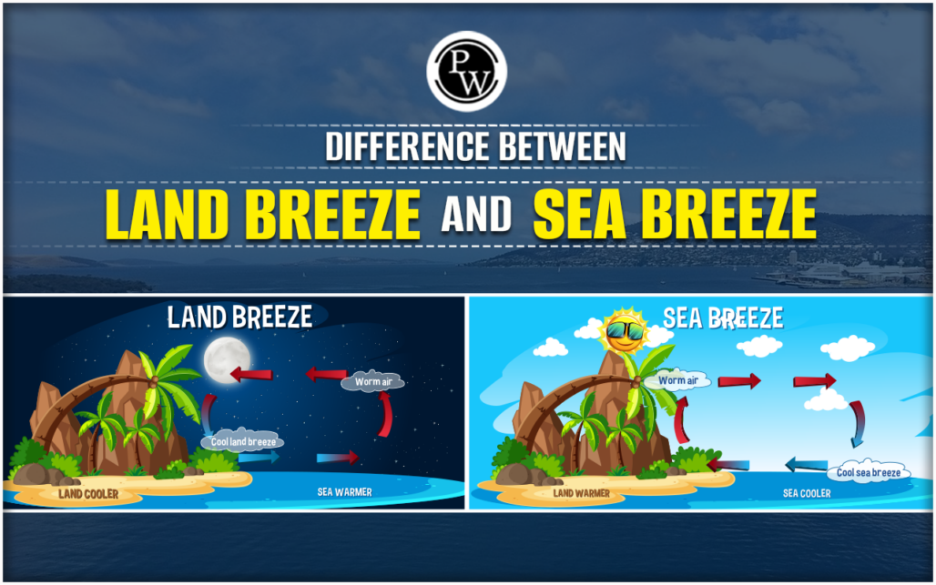
Sea-land breezes
Sea-land breezes (SLB) “are mesoscale circulation phenomena that significantly affect weather and air quality in coastal regions.”
The GBA experiences frequent SLB intrusion, according to a 2023 study, that examined the SLB features in the GBA from 2013 to 2022.
The annual average daily sea and land wind speeds ranged from 2.8 to 3.2 m/s and 1.9 to 2.2 m/s, and from 1.8 to 2.2 m/s and 1.6 to 1.9 m/s in the eastern and western GBA, respectively.
The start time of sea (land) winds first appeared at 0000 (1100) UTC and finally occurred at 0900 (2000) UTC.
Previous | Western part of Peninsula “is more sensitive to storm surge”